Go to content

How to do the Tongagiro Alpine Crossing in New Zealand
The Tongariro Alpine Crossing is, without a doubt, one of the New Zealand's best hiking trails. Along 20 kilometers you will pass by active volcanoes, arid plains, lava fields and lakes of a turquoise color that seems unreal in a completely surreal environment.
If you are a fan of Lord of the Rings The landscape may look familiar to you, and several scenes were filmed here, we could say that doing the Tongagiro Alpine Crossing It's like entering Mordor.
In this article we tell you Everything you need to know to do the Tongagiro Alpine Crossing, our experience and whether it is worth doing or not.
Travel Guide Tongagiro Alpine Crossing
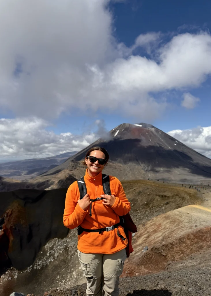
The Tongariro Alpine Crossing is one of the New Zealand's best hiking trails, this runs through the heart of Tongariro National Park, a protected area and declared a World Heritage Site by UNESCO due to its cultural and scenic importance. The stars of the route are the Mount Tongariro and the Mount Ngauruhoe, the latter famous for its appearance as Mount Doom in The Lord of the Rings.
The volcanic area is very active, in fact, Mount Tongariro had its last eruptions in 2012. And Ngauruhoe in 1975, but it still continues to record strong activity. The place is really spectacular, even if you have seen other volcanic areas, as was our case living in Iceland, the National Park will surprise you.
Is the Tongagiro Alpine Crossing difficult?
Before starting with the practical information you need to do this hiking route in New Zealand, we answer the most frequently asked questions: Is it difficult? Do you need to be very fit to do the Tongagiro Alpine Crossing? Due to its popularity and relationship with the Lord of the Rings Many tourists venture to do it, and no, We don't think it's for everyone.
For us, who are used to walking in the mountains, it was a long but easy route. Except for the descent to the Esmelad Lakes, which is steep and with loose stones, There is no technical terrain and the climb is progressive and well equipped.
As I say, although it is not difficult, it is still 20km through the mountains and more than 1000 meters of elevation gain. If you are not used to walking in the mountains or doing sports, this route is not for you, you will complete it, but you will have a bad time.
How to get to the start of the route
The logistics of the Tongariro Alpine Crossing are not as straightforward as other New Zealand hiking routes. As it is 19km one way, you will need to hire a space shuttle to get to the start of the trail, to pick you up at the end, or both.
There are three options To do the Tongagiro Alpine Crossing, I'll tell you:
1 - Leave your vehicle at the Ketetahi Carpark, point from where most of the shuttlecocksThe bus will drop you off at Mangatepopo Carpark, where the route begins, which after 20km and many volcanic landscapes takes you back to Ketetahi.

2- Appearcar your vehicle in one of the surrounding villages, or at the Tongariro Holiday Park and arrange transport so that take you to the start and pick you up at the end. It is not our favorite because it involves having to be aware of the pick-up times. You can also hire transportation from taupo.
3- Do it alone half of the route, starting at Mangatepopo Carpark to the red crater and back. The downside is that the parking lot only allows you to stay for 4 hours, but if you walk at a good pace it shouldn't be a problem. It took us about two hours to go up. The good part is that you save the shuttle, which is not cheap, and since the second part of the route is a descent that zigzags endlessly, you don't miss much by not doing it.
We opted for the first option, but if we were to return we would do the third. In fact, once you pass the red crater the route becomes rather boring, most of the kilometres are going down an eternal zigzag. After seeing the landscapes you have passed through, this last stretch is not enough. If you are in good physical shape, I would recommend doing it this way.
Best time to go to Tongariro Alpine Crossing
The best time to do the Tongariro Alpine Crossing is during the warmer months, from November to AprilThe weather conditions are more favourable and the trail is usually free of snow. We went in mid-November.

It is important to note that the climate in this region is very changeable and that even in summer there can be strong storms. It is important to check the weather conditions before setting out on the hike, in fact, the shuttle companies themselves They do not operate when bad weather is forecast. Don't forget to bring down, a raincoat, water and food with you.
The route can be done all year round, but in the middle of winter it is covered in ice and snow, so it is not recommended to go without technical equipment or mountaineering experience.
⚠️ To do the Tongagiro Alpine Crossing in 2025 you must register on a DOC form (Department of Conservation). Daily quotas are being studied. Here is the form.
Tongariro Alpine Crossing step by step
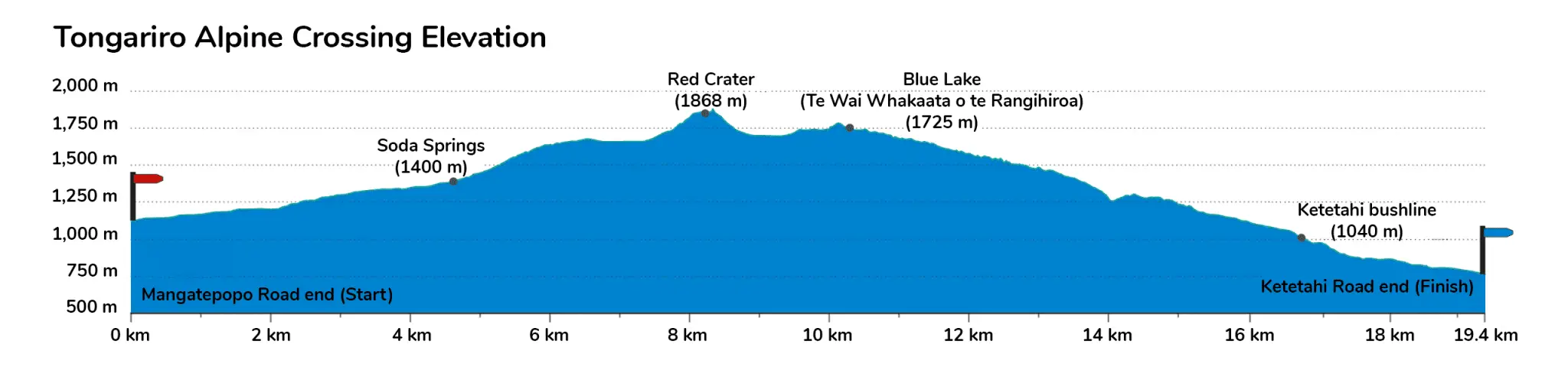
We leave you the Elevation profile and a summary of the stages of the route starting at Mangatepopo Car Park.
1 - Mangatepopo Car Park to Soda Springs
- Distance: ~ 4 km
- Estimated time: 1 – 1.5 hours
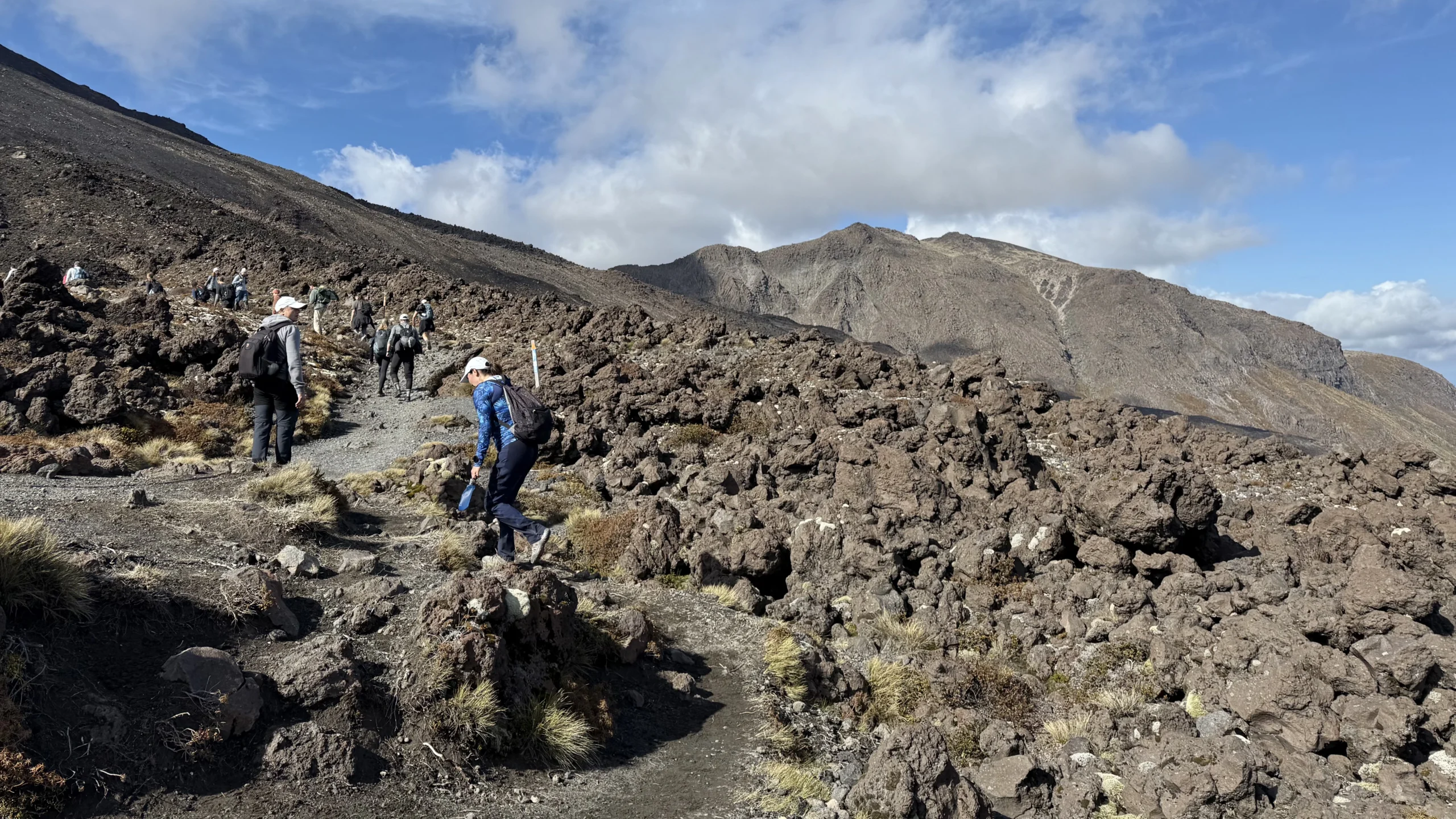
- This initial stretch is almost flat, with a slight upward slope. The trail is well-maintained, alternating between dirt roads and wooden walkways. At the end of this segment, you can take a short detour to visit a small waterfall, Soda Springs.
2- Soda Springs to South Crater
- Distance: ~ 2 km
- Estimated time: 1 time
- Here begins the climb known as the Devil's Staircase, a steep section that reaches 1.600 meters above sea level. It is well equipped and has corners to stop and rest if you need to.
3- South Crater to Red Crater
- Distance: ~ 2 km
- Estimated time: 45 – 60 minutes
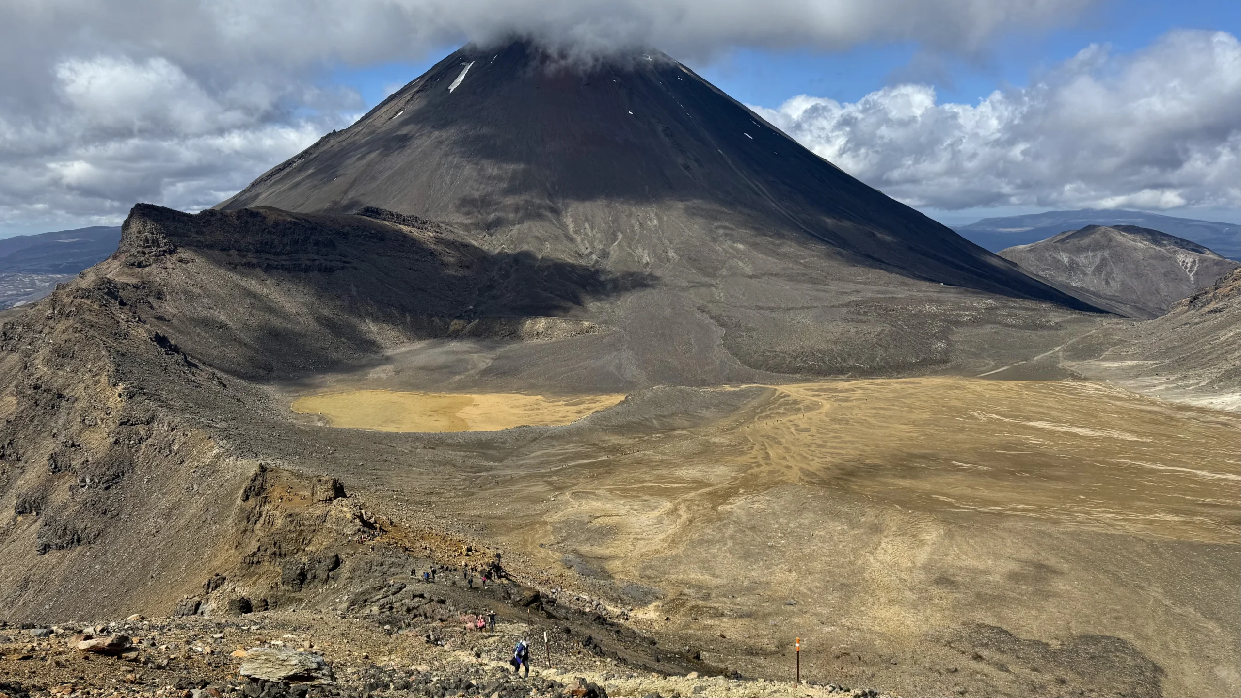
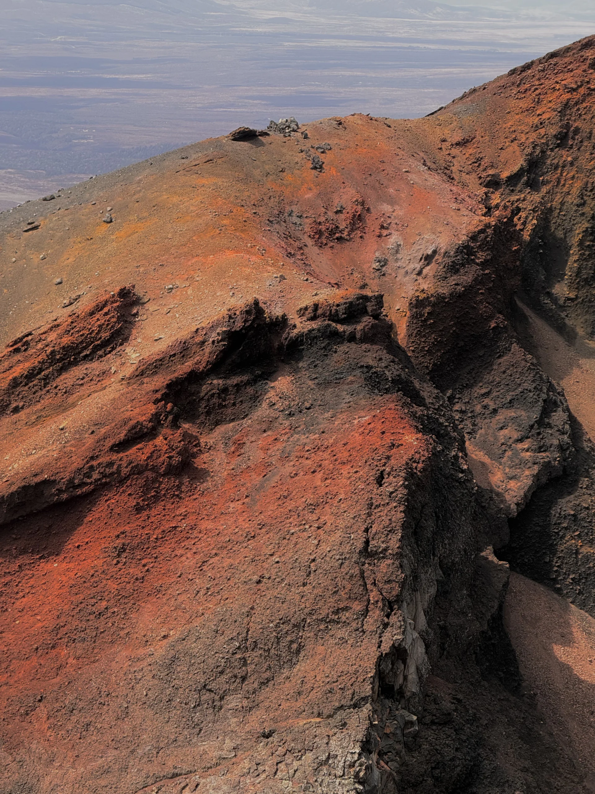
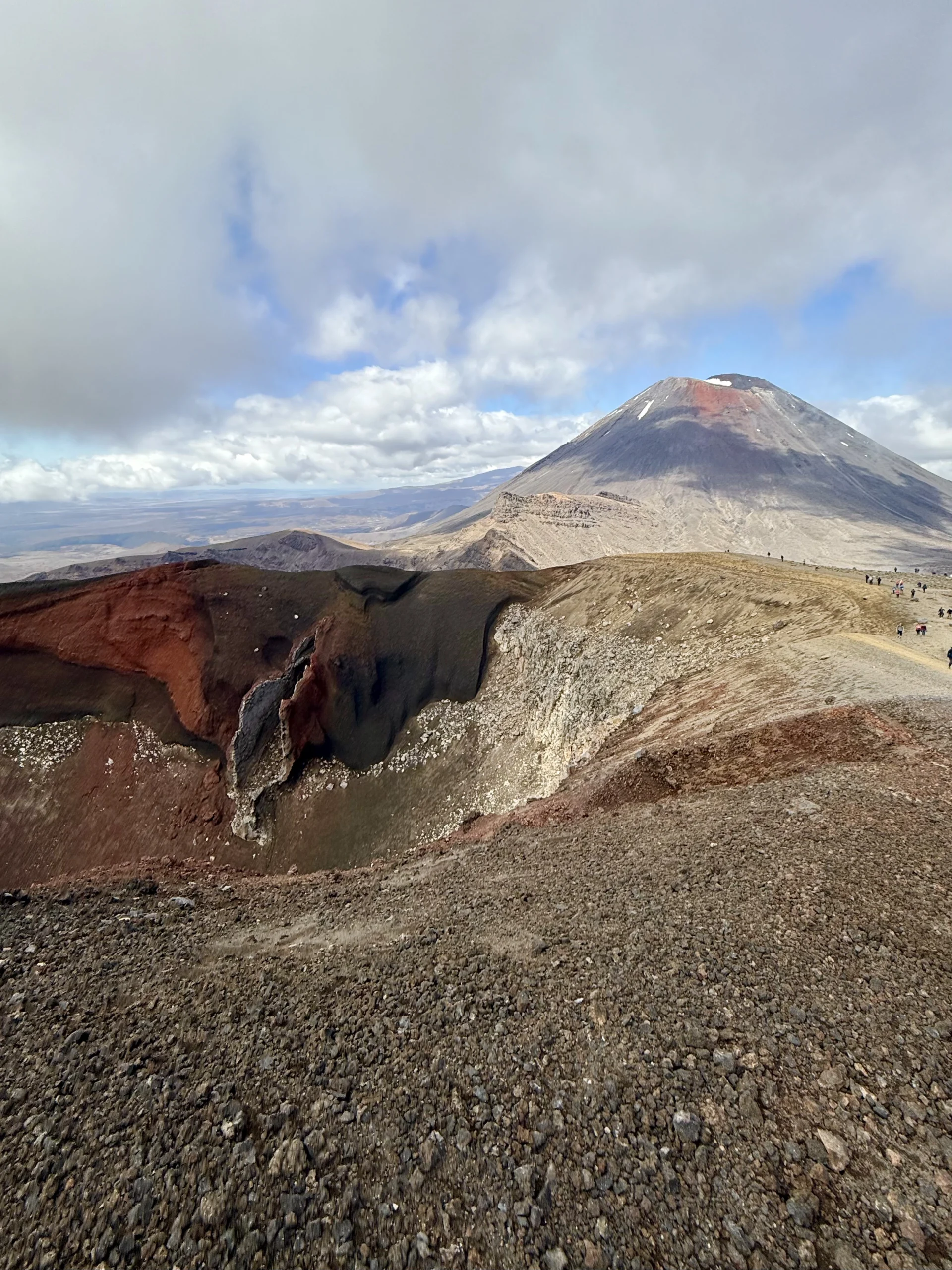
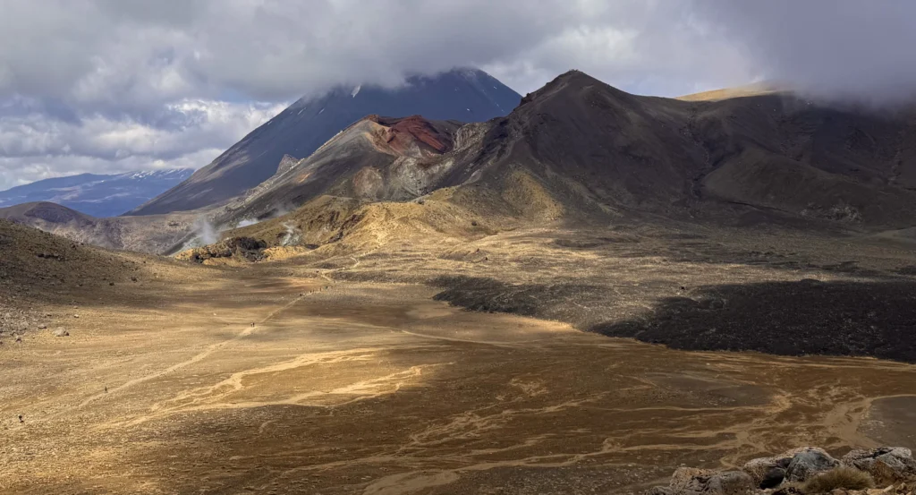
- The trail crosses South Crater, a wide, flat area of about 700 metres that offers a respite to enjoy the views of Mount Ngauruho before the climb to Red Crater, the highest point of the route at 1.886 m. Here the path is narrow and the gradient quite steep, as can be clearly seen in the image we have left with the elevation profile. There are toilets along the way.
4- Red Crater to Emerald Lakes
- Distance: ~ 1 km
- Estimated time: 10 – 20 minutes
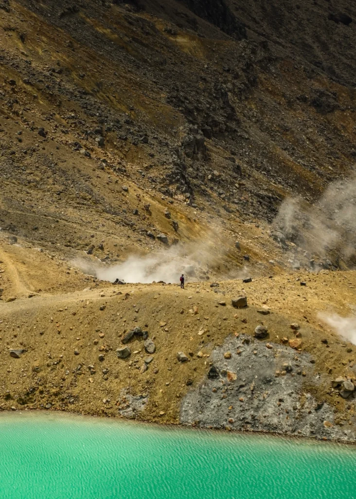
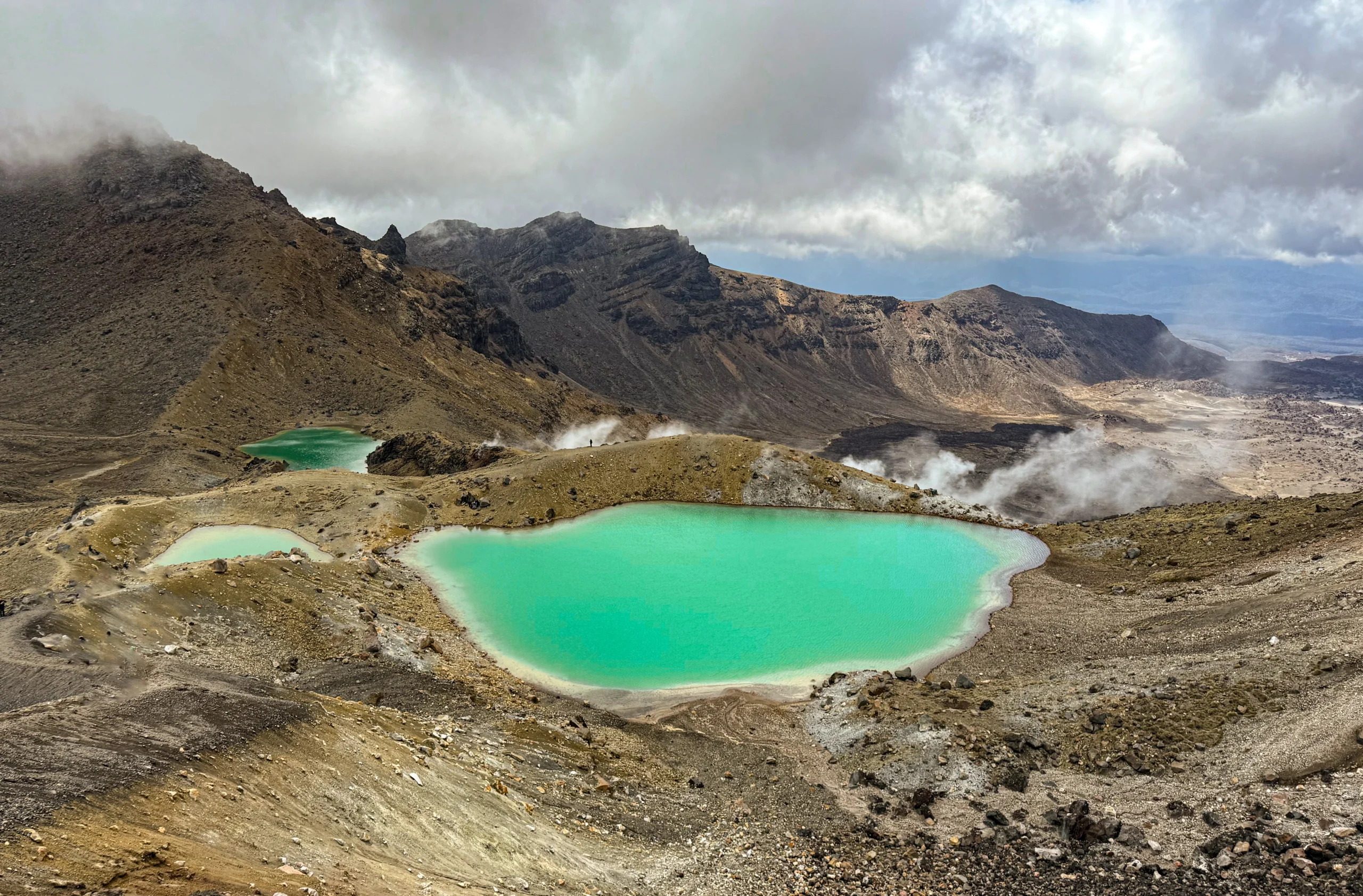
- The descent from Red Crater to Emerald Lakes is short but steep, with loose terrain that requires caution and leaves your shoes covered in dirt. We could say that it is the most difficult section of the entire Tongagiro Alpine Crossing. During the descent you have different perspectives of the lakes, a beauty.
5- Emerald Lakes at Ketetahi Hut
- Distance: ~ 5 km
- Estimated time: 1 – 1.5 hours
- The trail continues downhill, with a slight climb before reaching Blue Lake, which is not as impressive in color, but is still beautiful. This stage is very easy, but it is usually where the most snow accumulates, so if you are trekking in early autumn, it is very possible that you will have to walk through snow.
6- Ketetahi Hut to Ketetahi Car Park
- Distance: ~ 6 km
- Estimated time: 1.5 – 2 hours
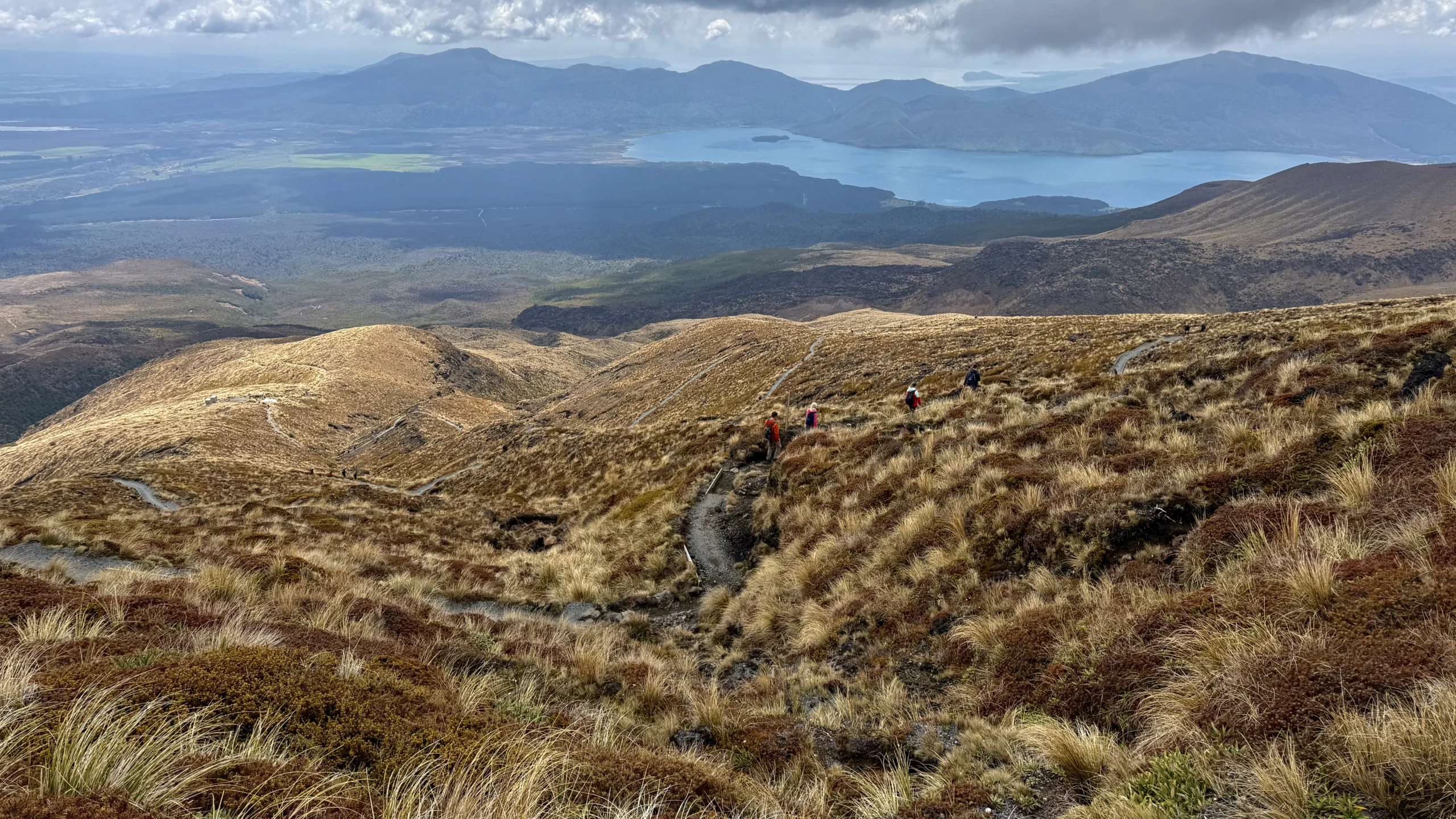
- The final section is a steady, somewhat knee-destroying downhill with views across the valley to Lake Rotoaira. The final stretch is through woodland. By the time you reach it you are about 20-30 minutes from Ketetahi Car Park.
What you need to do the Tongagiro route
These are our Tips for doing the Tongagiro Alpine Crossing safely and without surprises.
- Water – There are no water sources along the way, so make sure you bring enough water for the entire hike. One and a half liters should be enough.
- Appropriate clothing – The temperature can change quickly, so it is essential to wear several layers of clothing. Make sure you bring something warm, even if the weather seems warm at first. And if you have one, take a raincoat with you too.
- Solar protection – Even though the weather may be cloudy, the sun in New Zealand is very strong, so don’t forget sunscreen, sunglasses and a hat.
- suitable footwear – You can do it in sneakers, but if you are undecided about whether or not to bring hiking shoes to New Zealand, it is better to opt for shoes with good soles.
- Food and snacks – Bring some food to replenish your energy. We were back in the camper at around 2 to eat, but we did bring several snacks.
- Hiking poles – If you have poles, they will be very useful, especially for the final descent and the descent of Red Crater.
Another thing to keep in mind is that this Use of drones is prohibited y You can't climb to the top of Ngauruhoe neither thatcar the water of the Emerald Lakes for conservation and because they are considered sacred places.
🥾 Write down more hiking ideas!
Climbing Roys's Peak
1 day routes in Abel Tasman
Routes on Mount Cook
A good recommendation is that you start as soon as possible, The National Park has a reputation for clear mornings and stormy afternoons.
You can read... complete guide what to see in Rotorua, another must-see on the North Island.
Is the Tongagiro Alpine Crossing worth doing?
Of course! Despite having seen volcanic areas in other countries We found Tongagiro National Park spectacular. We have no doubt that this is one of the best hiking routes in New Zealand. For nature lovers, Lord of the RingsOr both! It's a must-see in the country and well worth the effort.cara day of your New Zealand itinerary.
On the other hand, if you don't like mountain walking I think there are many other places in New Zealand that you will enjoy more. Keep in mind that there are some Other shorter hiking routess through the National Park, such as Tama Lakes.
And that's all about it Tongariro Alpine CrossingIf you have any additional questions, please feel free to leave us a comment. And if you enjoyed this article, you can continue exploring our guides to travelling around New Zealand and discover more hiking routes, practical tips and everything you need to know to organise your trip to the antipodes. Thank you for reading!